
 Ash from an ancient Oregon Volcano?
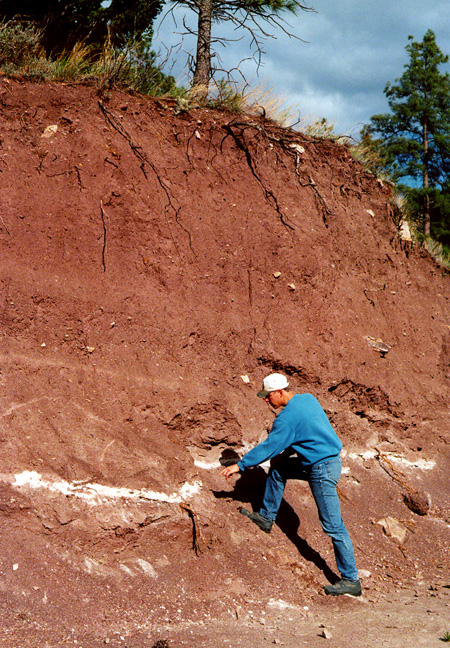
This photo was taken 12 miles northeast of Helena, Montana. It shows a layer of ash from an ancient volcanic eruption in Oregon. Volcanic ash is formed when gases cause lava to explode into tiny fragments and/or the eruption shatters part of the volcanic mountain (rock) into a glass-like dust. Geologists can determine where ash originated by comparing its chemical composition with the compositions of volcanoes found in the region. The layer shown in the photo formed as a result of the explosive eruption of Mt. Mazama 7,700 years ago. According to the January 1991 issue of National Geographic Magazine, the volume of ash produced by Mazama was forty-two times greater than the amount produced by St. Helens in 1980. Prevailing winds caused the ash to spread eastward. Initially the ash covered much of the ground in the Northwestern USA, but wind and water transported it to lower places, including valleys and lakes. The sediment above the ash layer (in photo to right) was deposited in the centuries after the ash settled here. Then the wall was exposed when road construction cut into the slope. Mazama' eruption also emptied significant amounts of magma from the chamber beneath the mountain. After the eruption the remaining cone collapsed into the chamber, forming a huge crater known as a "caldera". Today, Crater Lake (Oregon) fills the caldera of Mt. Mazama.
Extreme ash . . .
A "Marker" for the Northwest . . . Below: This roadcut, which also exposes ash from Mazama, is along a frontage road near Dearborn (mid-way between Helena and Great Falls). 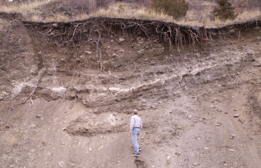 Term: Paleo-Indian |
|
Earth Science Teacher at Helena High School |
