
|
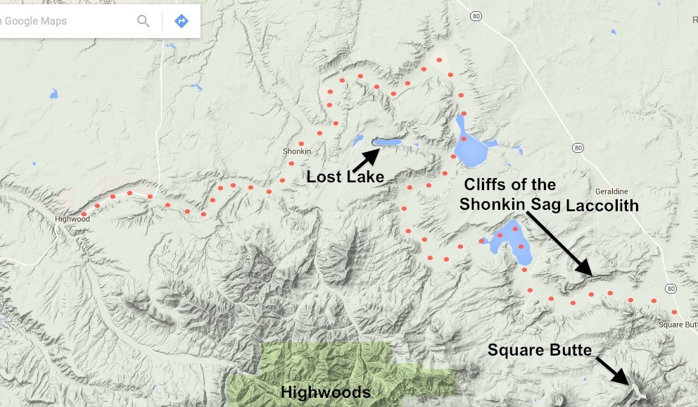
I took this photo of my daughter as we were hiking up to the cliffs of the Shonkin Sag Laccolith. The broad valley below her is the channel carved by overflow from Glacial Lake Great Falls. It is called the "Shonkin Sag". Earlier that day, we hiked up onto Square Butte. NOTE: There are 11 "Square Buttes" in Montana. This one is east of the Highwoods (SE of Ft. Benton). Another prominent "Square Butte" is located near Cascade. Both of these "Square Buttes" are laccoliths. Below: The dotted line is the location of the Shonkin Sag. The path and intensity of the overflow varied, but the most distinct channel remaining today is the Shonkin Sag (marked by red dots on the map). Lost Lake is evidence for the variability of the flow. Although not part of the Sag, the lake was formed by a tremendous stream of water that included a 250-ft. waterfall on it's west end - proof that overflow from Lake Great Falls occasionally cut across there. BACK 

|