
|
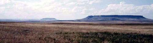
Above: Crown Butte (left) and Square Butte (right) as seen from I-15 near Ulm CLICK HERE to see photos from my hike to Crown Butte on April 16, 2011.
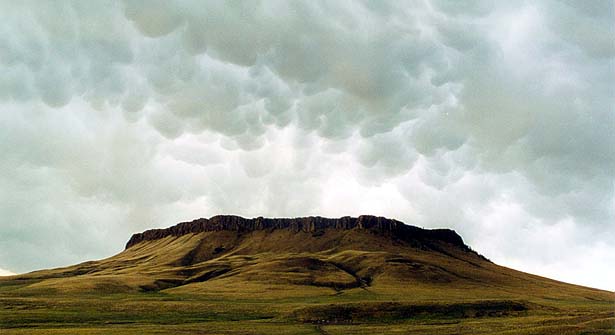
The details. . . . To get to Crown Butte, we will travel to Cascade and then get onto the gravel road that will take us toward Simms. It will take about 1.5 hours (85 miles) to get to the trail-head from Helena. The 6-mile round-trip hike will take us to the top of the spectacular cliffs along the east side of the butte (shown in photo below). The actual hike will take 3-4 hours (includes a break for lunch and exploration of the cliffs). CLICK HERE to see an aerial view of the path we will take to the cliffs. We will drive through Simms (then left at Bowman's Corner to Wolf Creek) on the way back to Helena. To learn more about Crown Butte, check out the virtual field trip below (see Hot Link). Most of Crown Butte belongs to the Nature Conservancy, and they do not allow dogs on the butte. CLICK HERE for the weather forecast at Crown Butte. CLICK HERE to see the web cam that looks from Great Falls toward the Crown Butte area. You can see Square Butte in the web cam view.
 |
 |
Crown Butte Virtual Field Trip |