|
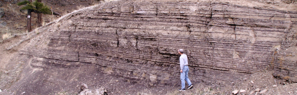
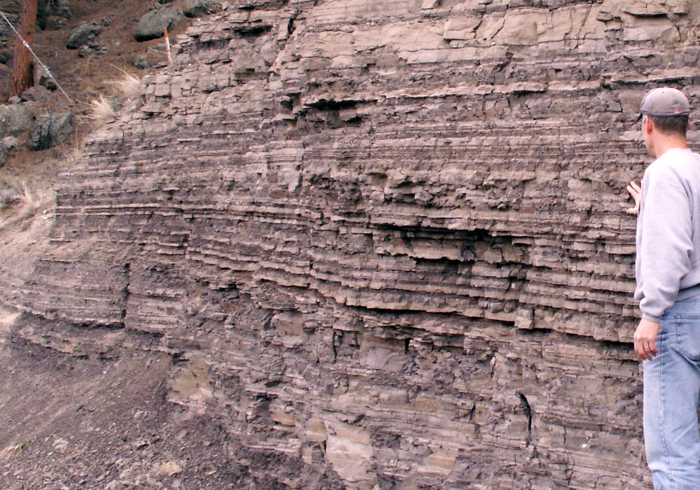
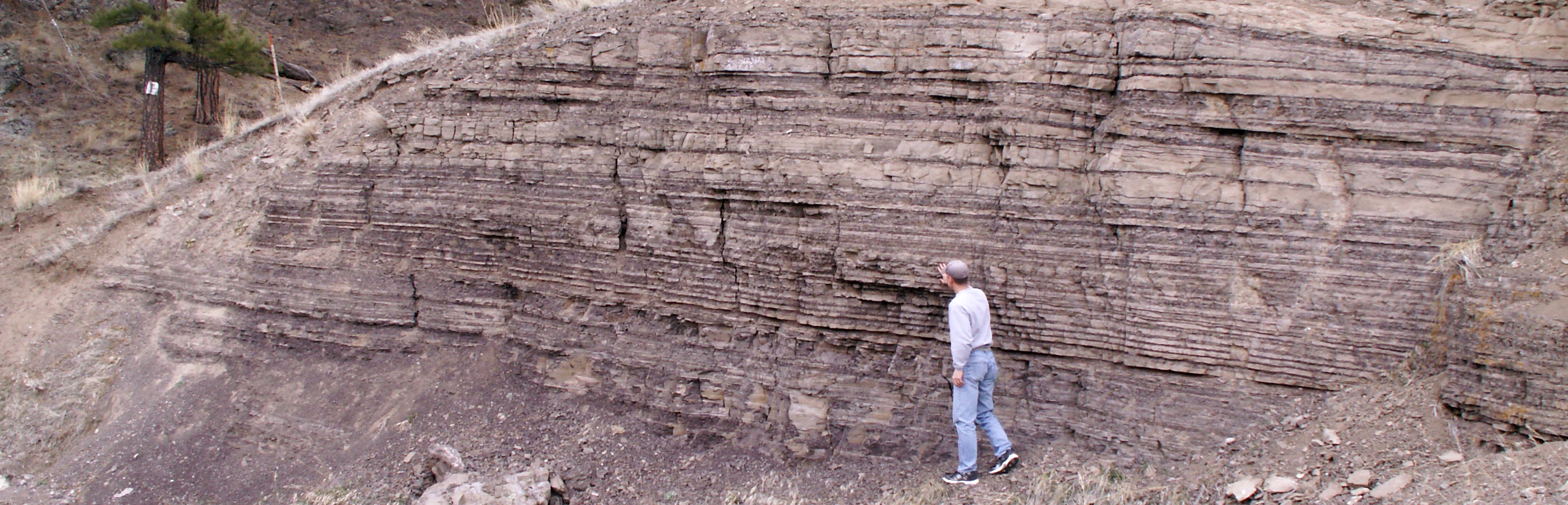
Varves from Glacial Lake Great Falls
 CLICK HERE to see a much larger version (1.3 MB) version of the photo.
Like tree rings . . .
The photos on this page were taken near the Missouri River by Craig, Montana (between Helena and Great Falls). The alternating layers of light and dark sediments were deposited on the floor of Glacial Lake Great Falls over 10,000 years ago. The light-colored layers were formed during warm months as abundant meltwater transported sand and silt to the lake where it settled to the bottom. The darker layers are beds of clay formed from much smaller clay particles that were kept suspended in the lake during the brief summers by currents and wind-driven circulation. As winter approached the lake froze over, becoming calm enough for the tiny clay particles to sink to the bottom. Flocculation, the clinging together of clay particles due to static charges, also helps clay settle in the winter. The dark coloration of the clay layer is due to the presence of organic material. Every melting season (3-5 months) another layer of sand/silt was deposited, followed by another layer of darker clay during the winter, producing the layers seen in the photos. Typically winter layers are all about the same thickness, whereas summer layers tend to vary more due to differences in weather that influence the amount of meltwater. 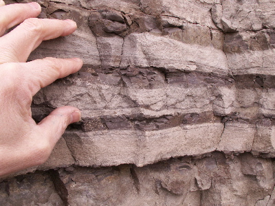 Look closer . . . Look closer . . .
Occasional periods of calm or other events during the summer did allow some thin layers of fine sediment to be deposited. These "laminations," which can be seen in the larger version of the photo to the right, might represent diurnal layering,
melting events (very warm days), or storm runoff events.
. CLICK HERE to see a larger version (1.3 MB) of the photo to the right.
No critters allowed . . .
Geologists call these alternating annual layers of sediment varves. Not all glacial lake sediments exhibit layers as distinct as those shown on this page, and varves are not limited to glacial lakes. Varves may form in other environments, including modern lakes that are fed by meltwater during the summer, followed by temperatures that drop low enough to freeze the surface of the lake during colder months. Another requirement for the formation varves is that the sediments cannot be disturbed by worms, mussels, and other bottom dwellers that tend to mess up the distinct layers by burrowing into them.
Cold, but not too cold . . .
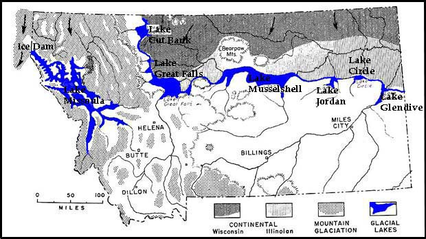
Earth entered the current ice age* 2.5 to 3 million years ago. Over the past several hundred thousand years there have been glaciations (commonly referred to as ice ages) about once every 100,000 years. Glacial lakes, such as Lake Missoula and Lake Great Falls, were not always present during these ice ages. The formation of glacial lakes in Montana 11,500 to 20,000 years ago happened when a couple of factors combined. In the case of Lake Great Falls, the continental glacier had to grow far enough south to reach the Highwood Mountains east of the present-day city of Great Falls. When this happened the ice and mountains combined to block the flow of the ancient Missouri River, causing the lake to form. A second requirement is that climate had to be warm enough for melting to occur. During the coldest centuries of the recent ice age it was too cold and dry for there to be any runoff so rivers would have dried up. However, during warmer centuries within the ice age, rivers flowed again and glacial lakes would have formed. It is difficult to know exactly when the lakes were present (and how often they formed), but estimates generally fall within the time frame of 11,500 to 20,000 years ago.
Driving directions to the varves . . .
From the interstate between Helena and Great Falls take the Crag exit, drive through Craig and continue across the bridge (Missouri River). Turn left onto the frontage road and drive about 1.5 miles. The varves will be on your right. (If you get to mile marker "18" you've gone too far.)
Terms: bioturbation, laminations, flocculation, diurnal
Sources: (also see hot links below)
1. Davidson, Gerald. Ph.D. Theoretical Physics, Retired Research Scientist: Lockheed Palo Alto Research Laboratories, Space Sciences Laboratory: (http://home.onemain.com/~gdavids/index.html).
2. Ridge, J.C., 2008, The North American Glacial Varve Project: (http://ase.tufts.edu/geology/varves), sponsored by The National Science Foundation and The Geology Department of Tufts University, Medford, Massachusetts.
3. Thomas, Rob. Ph.D. Geology, Dept. of Environmental Sciences, University of Montana Western.
*The term ice age can be confusing. To a climatologist, an "ice age" is a long relatively cold period (lasting millions of years) during which the Earth experiences multiple glaciations. Glaciations are shorter periods of tens of thousands of years when continental glaciers grow toward the equator, covering a significant portion of the Earth. On the other hand, in the media and pop culture, it is these glaciations that are referred to as "ice ages". To a climatologist, the current ice age started 2.5 to 3 million years ago, and the most recent glaciation peaked about 20,000 years ago. Climatologists remind us that we are still in this ice age . . . and the current warm period, which started over 10,000 years ago, is simply an interglacial period.
|

