|
Lake Helena Watershed 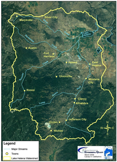 It's all downhill from here . . .
For a drop of water (rain or melted snow) on a mountain slope there are three options - evaporate, soak into the ground, or flow downhill. A drop that flows becomes "runoff", and will soon join with other drops to form a trickle and eventually a small stream. Any runoff within the yellow line shown on the map eventually ends up in one of the larger streams (blue lines) that channel water to Lake Helena. From there runoff flows into the Missouri River, onto the Mississippi, and finally into the Gulf of Mexico.
a.k.a. Drainage Basin . . .
The outlined area on the map is called the Lake Helena Watershed (larger version of map). It includes the Helena Valley and the surrounding mountains where the water comes from - mostly from melting snow. A watershed is all the land whose runoff flows into a particular river or body of water (animation). The watershed of the Mississippi (a.k.a. the Mississippi Basin) includes 41% of the lower 48 states. If you live in Helena, you live in the Lake Helena Watershed and you are also part of the Missouri River Basin (map) and the even larger Mississippi Basin (map). In fact most of Montana is part of the Mississippi Basin. But no matter where you live, you are in a watershed and human activities in that watershed may impact the quality of water available to you.
Water for the Capital City . . .
Wells (groundwater) are the source of water for many who live in the Helena area, including East Helena, Montana City, various subdivisions, and those not connected community systems. However, the primary source of water for the 30,000 who live within the city of Helena is surface water. Although the city does use some groundwater, most comes from two surface water treatment plants. The Missouri River Treatment plant, located in the Helena Valley, treats water that has been pumped from Canyon Ferry. Helena's main source of water is the upper portion of the Tenmile Creek Watershed. ("upper" means higher, or closer to the headwaters.) The Tenmile Water Treatment Plant, located 10 miles west of Helena, provides most of Helena's water.
Get it while you can . . .
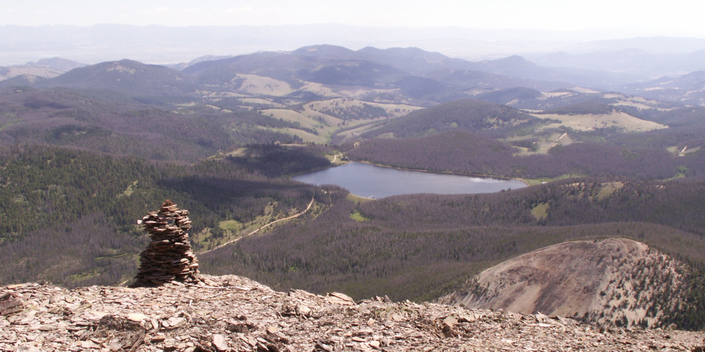
Since most of the runoff from the 42 square mile Upper Tenmile Watershed flows down from the mountains during spring and summer, the City of Helena devised a way to collect that abundance and store it for use throughout the rest of the year. Water from streams in the upper part of the watershed is stored in Scott (photo) and Chessman Reservoirs (photo). Chessman Reservoir is filled by water from Banner Creek - a tributary of Tenmile Creek. Water diverted from Banner travels through the 5-mile long Red Mountain Flume (photo) to Chessman Reservoir. From there it can be released as needed (mostly in winter) into another stream that takes to the Tenmile Plant. The plant cleans up the water, adds chlorine, and then pipes it into town where it is stored in tanks - ready for use (Gooble Earth image).
A troubled past . . .
Most watersheds have issues and the Upper Tenmile Watershed has more than its share. In 1999, the EPA added the area to the Superfund National Priorities List due to problems caused by waste rock and tailings at abandoned mines that produced gold, lead, zinc and copper from 1870 through the 1920s. Waste rock and tailings piled near these sites can cause acid mine drainage which taints runoff with dissolved metals. The EPA identified 150 individual mine sites within the watershed . . . 70 have been prioritized for cleanup and some of these are above Scott and Chessman Reservoirs. Despite this problem, the Upper Tenmile Watershed continues to provide high quality water for the city of Helena.
Detailed Map of the Upper Tenmile Watershed a.k.a. "Helena's Watershed"
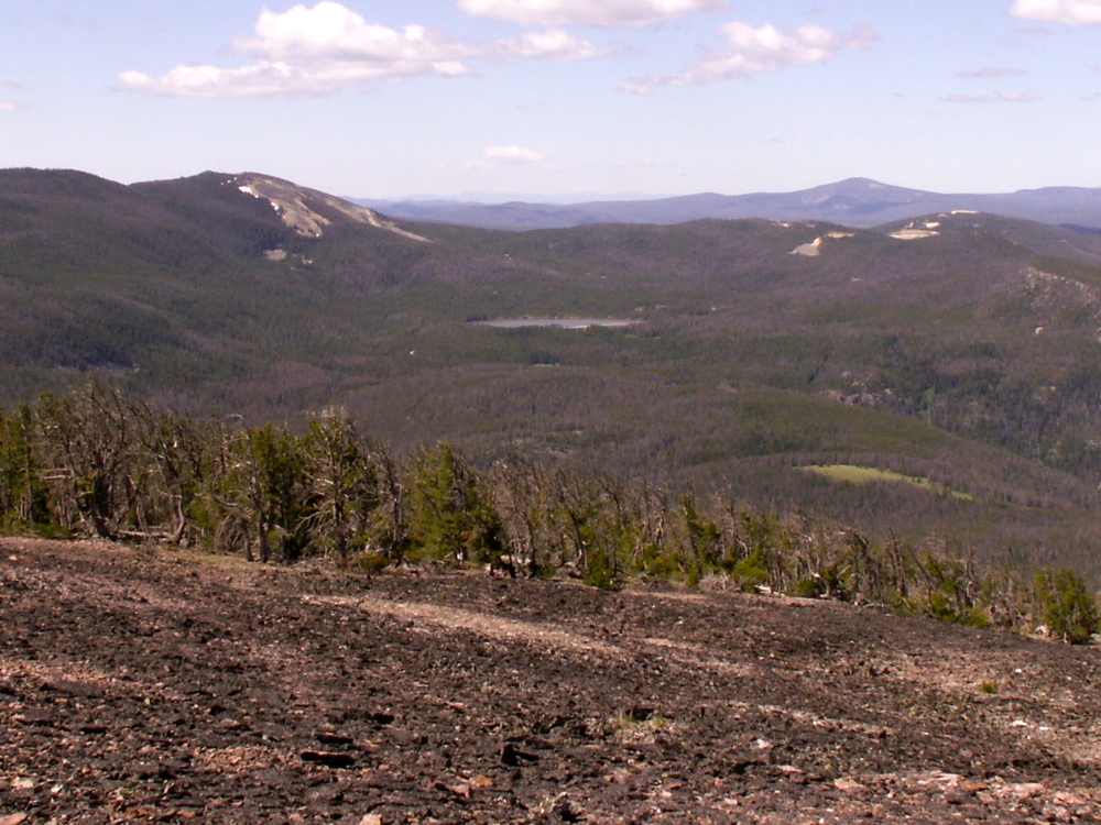
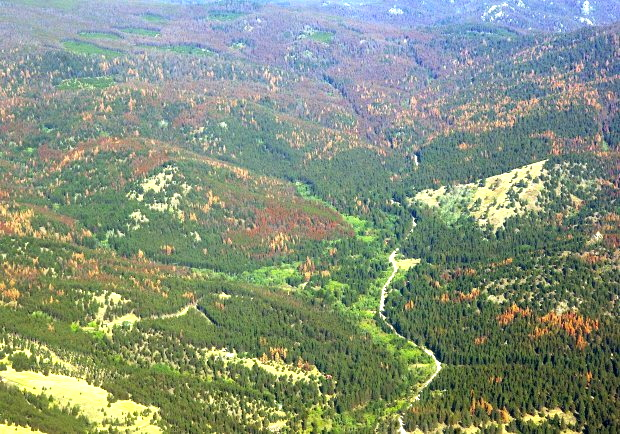
Below: Because the Upper Tenmile Watershed has been Helena's main source of water for decades, fires have been suppressed. As a result the forest has become thick, making it easier for pine beetles to infest trees (photo). According to the U.S. Forest Service beetles have killed trees in over 90% of the drainage, raising the risk that a fire could devastate the city's water supply. A fire would probably destroy the aging flumes (photo) that divert runoff to Chessman (photo) as well as trees and other vegetation that cover the slopes. Without vegetation to hold it in place soils would erode and toxic mine tailings could be washed into Tenmile Creek, making the water difficult to treat and clogging the treatment plant. The Forest Service has begun removing dead trees from the area around Chessman Reservoir and along the Red Mountain Flume. To learn more about the tree removal projects, watch the video below.
Term: tailings
|

