
|
The dashed line on this map shows the extent of the Laurentide Ice Sheet during the last ice age (glaciation). As it melted, starting about 18,000 years ago, rocks stuck to the ice were dropped all over the Hi-Line. (Map courtesy of Montana Bureau of Mines and Geology) BACK 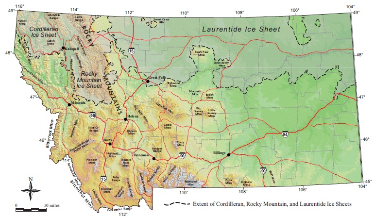 |
|
Earth Science Teacher at Helena High School |