|
2007 Fire and 2011 Floods Trigger Mass Wasting
Erosion in fast-forward . . .
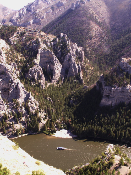
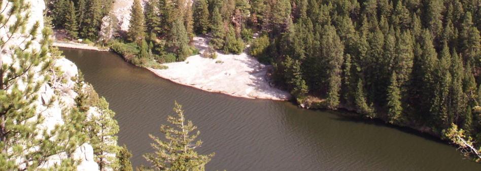
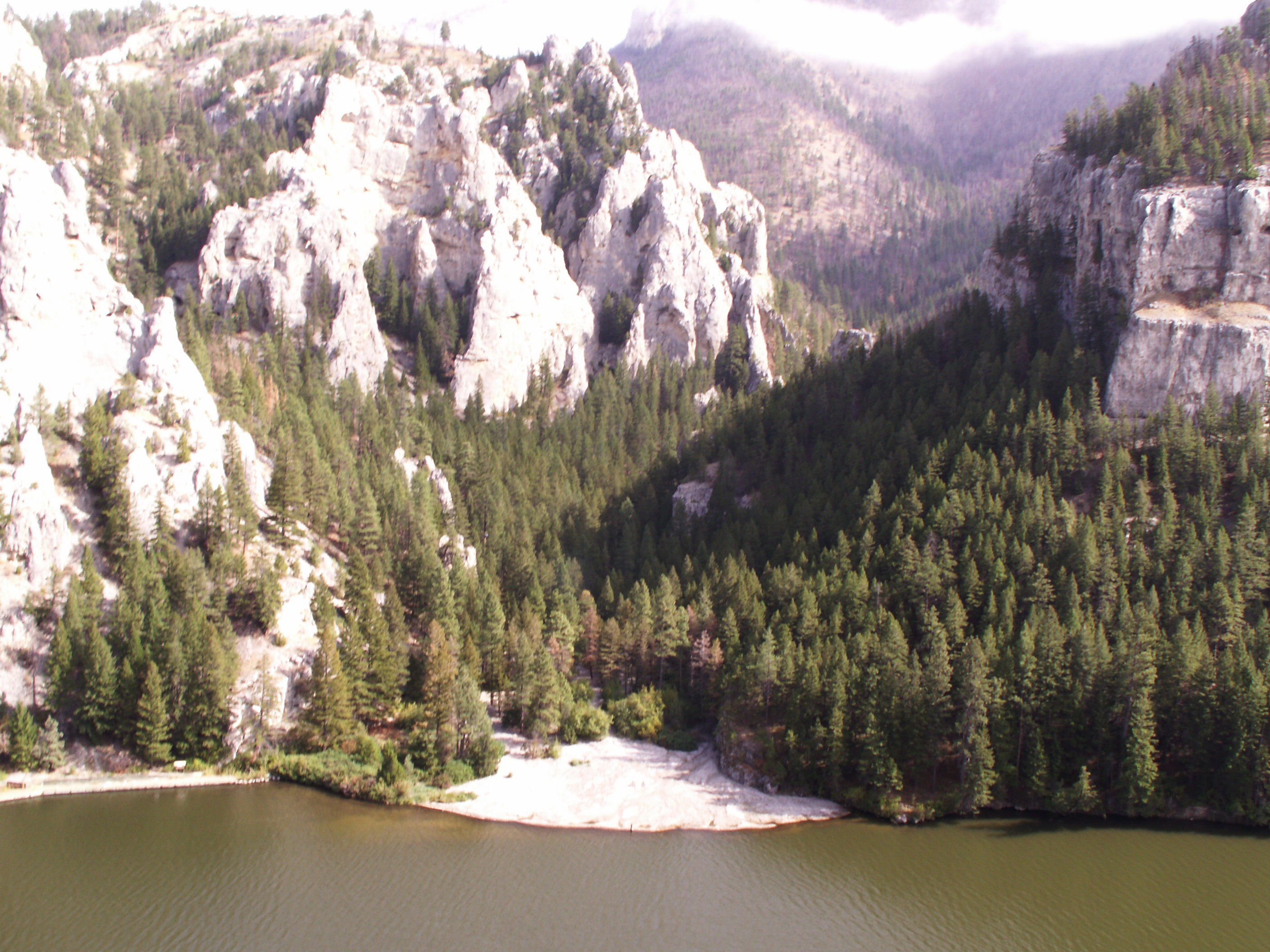
May and June of 2011 will be remembered for the historic flooding that occurred in many parts of Montana. This photo, taken from a cliff overlooking the Missouri River, shows how flood-waters impacted Meriwether Canyon 25 miles north of Helena. The white patch above the 60-ft. Gates of the Mountains tour boat is an alluvial fan that formed as runoff from melting snow and heavy spring rains transported tons of rock material from the Meriwether watershed to the place where the canyon empties into the Missouri River. The tour boat stopped at the mouth of Meriwether for several decades, but the floods put an end to that, depositing several feet of sediment around restrooms and drinking fountains. To see another view of the alluvial fan, taken from a different vantage point, CLICK HERE. Battleground . . .
The bedrock and outcroppings of the Meriwether watershed consist of Madison limestone that was laid down as sediment over 300 million years ago when Montana was the floor of a shallow tropical part of the ocean. The layers of limestone were pushed up 40-80 million years ago as crustal plates pushed together (forming the mountains of western Montana). As plate tectonics forced the layers up, weathering and erosion teamed to wear them down, carving valleys and canyons like the Gates of the Mountains and Meriwether Canyon shown here. A tough place to be dirt . . .
Slowly but surely soils formed on the limestone, and vegetation became established in parts of the watershed that were not too steep. Roots of trees, shrubs, and other vegetation helped keep the soil in place. In steeper areas the limestone remained uncovered by soil. These "outcroppings" are the white cliffs shown in the photo. Naked soils . . .
In 2007 fire swept through much of the Meriwether watershed, burning vegetation that held the soils and loose rock material in place. Then, in the spring of 2008, runoff (and gravity) started to bring down these loose materials (erosion). The bigger pieces (gravels) were dropped at the mouth of the canyon where the water slowed as it emptied into the Missouri (deposition). Smaller pieces, including sands, and silts were carried farther out into the river or transported downstream. This process accelerated in the spring of 2011 due to record snows and spring rains that eroded tremendous amounts of material, greatly increasing the size and extent of the alluvial fan shown in the photo. Slow down buddy! . . .
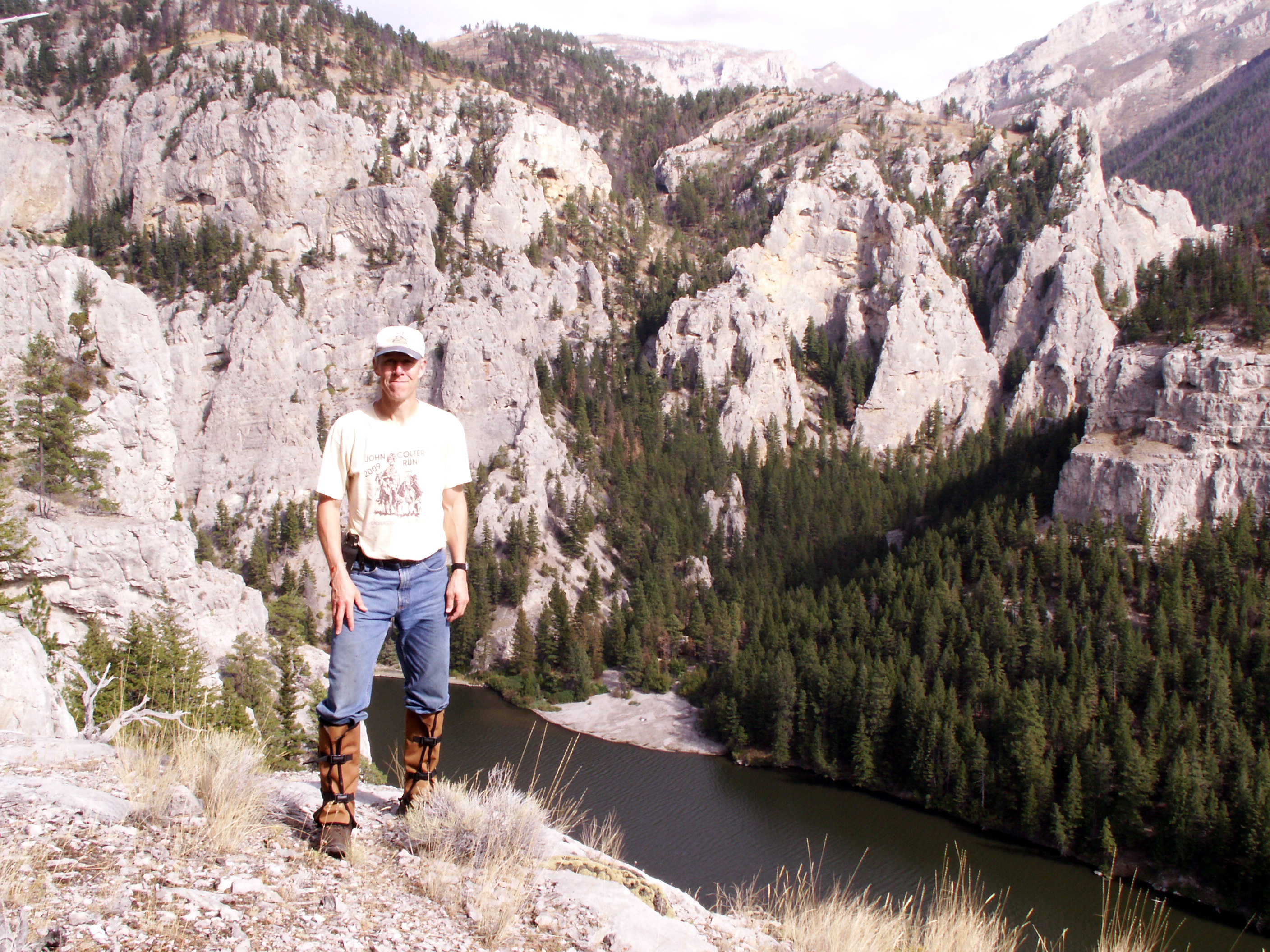
An alluvial fan is a fan-shaped deposit of rock material formed where a river flows from a steep mountainous area or canyon onto a flatter one. As the water slows down it loses its ability to transport larger pieces of rock, so gravels are deposited. This fan formed in a river, which is somewhat unusual. The deposit of gravels that make up this fan extends back about 200-400 meters from the bank of the river. Below: Move your cursor over the image below to see the boundary of the Meriwether watershed, the location of the alluvial fan*, and the location from which the photo above was taken (A). CLICK HERE to see a photo of the upper part of the Meriwether watershed taken from location B. 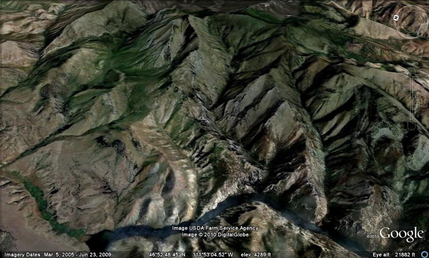 One more photo . . .
CLICK HERE to see a large photo that shows my (Rod Benson) vantage point. When the image appears, click on it again to make it bigger and then scroll around to get a nice view of the alluvial fan. You can actually see (not read) the "Meriwether Closed" sign.
Term:mass wasting, residual soil
| 
