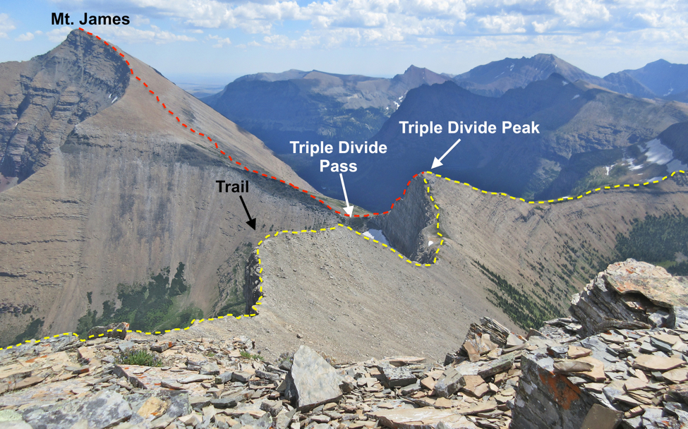
Compare the photo to a map.

Right: The photograph was taken looking toward the southwest. The red dashed line is a portion of the Continental Divide. The yellow dashed line is the divide that separates the runoff that flows into the Gulf of Mexico from runoff that flows to the Hudson Bay. The area beyond Triple Divide Peak (including Mt. Stimson) is part of the Columbia River Basin. Snow that melts in that area flows toward the Pacific Ocean.

HOT LINKS

RETURN TO BASE CAMP

Left: The red arrow on the map is the approximate vantage point of the photographer. The boundary between Glacier County Flathead County is a portion of the Continental Divide that corresponds to the red dashed line on the photo above. The map is from the U.S.G.S. topographic map called the "Mount Stimson Quadrangle" (7.5 minute series).