
|
Lewis and Clark were here, and so was Kevin Costner . . .
Leftovers from an ancient volcano. . . .
Clues in the igneous rocks . . . 1. For one, the age of igneous rocks can be determined using radiometric dating techniques. As the molten rock solidified, gases trapped within mineral crystals can be analyzed to determine when the magma hardened. Radiometric dating indicates that this part of Montana was volcanically active from about 81 to 71 million years ago. . . long before Lewis and Clark, and Kevin Costner stopped by. 2. Igneous rocks also help scientists figure out where a land mass was when the magma or lava cooled. Magma and lava consist of a mixture of minerals, some of which are sensitive to magnetism. As the molten material cools, these magnetic minerals orient themselves like compass needles, indicating where the magnetic north pole is. Then as the magma or lava hardens, those minerals are locked in that position, telling future geologists which direction it was to the magnetic north pole when that particular igneous rock formed. This can help geologists learn about the movement of crustal plates and the location of continents in Earth’s past. 3. Since the igneous rocks in this particular were formed as flows along the slopes of volcanoes, they could also be used to estimate the size and shape of the volcanic cones. Although only the bases of the cones remain, it would be possible to measure the angles of the tilted layers that are left, plot them on a map, and extrapolate to reconstruct the volcanic landscape. The outcropping behind the bridge (above photo) shows some of those tilted layers, which were flows on the slope of a volcano. 4. Another type of information that scientists can learn from igneous rock is whether the molten material cooled above the surface (lava) or beneath the surface (magma). When magma cools beneath the surface it cools slowly, giving the minerals time to arrange themselves in an orderly manner. As a result larger crystals (or grains) form. If you examine a sample of granite you will see several different minerals that started to form crystals before the magma hardened. In contrast, when lava erupts onto the surface, it cools quickly, giving little time for crystals to form. Igneous rocks formed in this way, such as basalt, tend to be fine-grained. 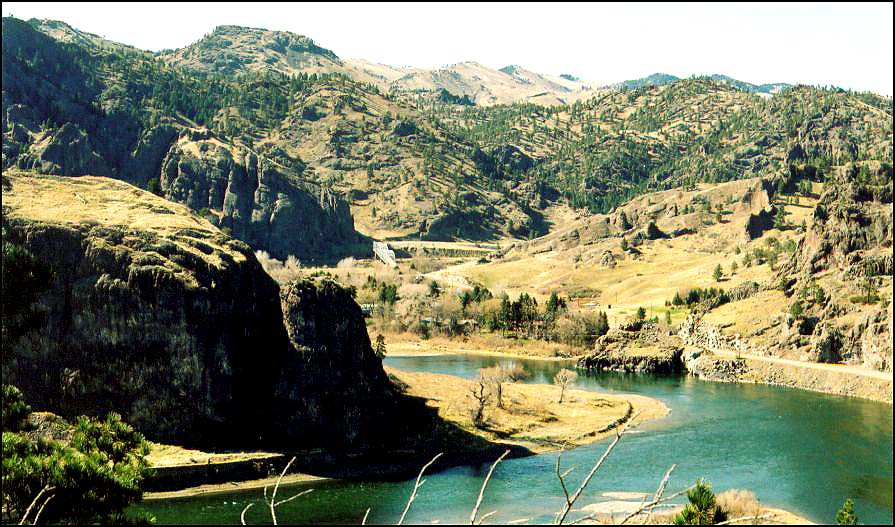 Sources: 1.Alt, David. "Adel Mountains" Profiles of Montana Geology; published by the Montana Bureau of Mines and Geology in cooperation with the Montana Magazine 1984 2. Alt, David, and Donald W. Hyndman, Northwest Exposures, Missoula, Montana: Mountain Press Publishing Company, 1995. 3. Sheriff, S.D., and Gunderson, J.A., 1990, "Age of the Adel Mountain volcanic field, west-central Montana": Isochron/West, no. 56, p 21-23. Terms: volcanic pile, radiometric dating |
|
Earth Science Teacher at Helena High School |
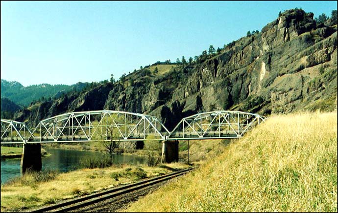
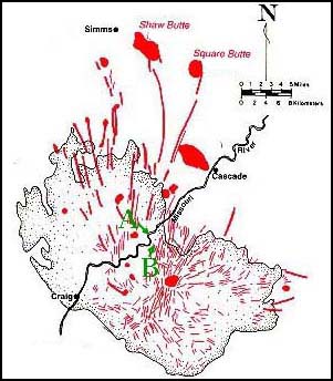 Right: This map from Northwest Exposures shows the extent of the volcanic center. A is the where the top photo was taken. The photo at the bottom of this page, which shows the same bridge, was taken from a “scenic turnout” along I-15 near the place marked B on the map.