
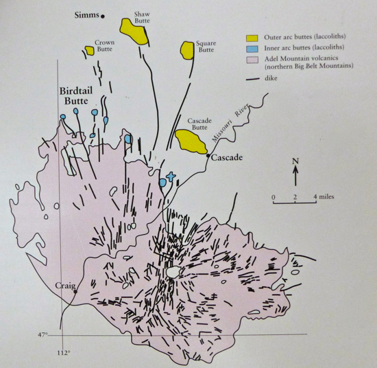
 Ancient Volcanism . . . Ancient Volcanism . . .If you've ever driven from Great Falls to Helena, you have driven through what's left of the ancient volcano. The part of the journey from Cascade to Craig goes right through the volcano which provided the magma for Crown Butte and other laccoliths in the neighborhood. The shaded area marks the extent of the ancient volcano, and the river shown on the map is the Missouri. Its headwaters are about 100 miles south of here. Crown Butte is not labeled, but it is the red spot about 12 km south-southwest of Simms. (km x .62 = miles) The "Connection" . . .
|
 |
5. The Plumbing of a Central Montana Laccolith |