
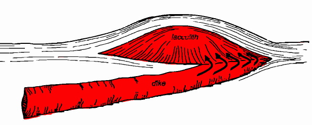
 A dike with a laccolith at its end. A typical laccolith is a mile or so across and several hundred feet thick. I was also granted permission to borrow this diagram from Northwest Exposures by David Alt and Donald Hyndman. According Alt and Hyndman, "this part of Montana is one of the best places in the world to see dikes connected to laccoliths that extend laterally from their tips , instead of standing above them like mushrooms on a stem." Interestingly, in the case of the Crown Butte laccolith, the layer of rock that was forced upward by the magma and then eroded away, was the Eagle Sandstone . . . the same rock layer that makes up the "Rimrocks" of Billings. Below: This aerial photo of Shaw Butte was taken by local rancher, Bob Rumney. It shows the dike that once provided magma to Shaw Butte. Millions of years ago, this ridge was molten rock moving from the magma chamber to the laccolith (Shaw Butte) through a crack in the bedrock. Examine this map to see if you can find Rumney's vantage point when he snapped the photo. A Hutterite colony can be seen in the distance. 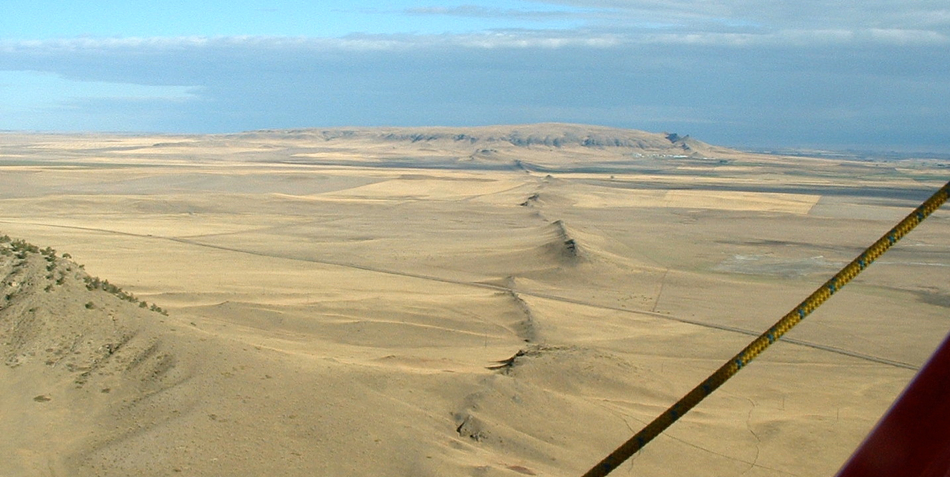 Photo Courtesy of Bob Rumney, Rumney Cattle Co. |
 |
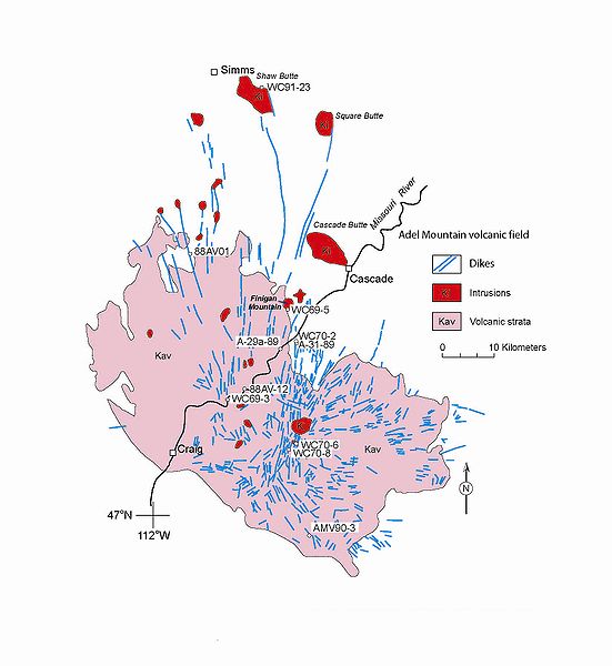
6. Aerial View of Crown Butte |