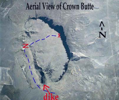
 The photo above
was contributed by the Nature
Conservancy, the organization that owns
the butte. - The blue dashed line
indicates the path of our hike to the top of the
butte. The blue line is about 2 miles long.
- The X is about where the
Nature Conservancy's plaque is
located, and is also where the photos of the
cliffs were taken (you will see these later in
this virtual field trip).
- The Z marks the location of
the columnar jointing photo which you will
also see later.
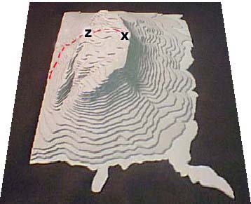
The model shown
below provides another perspective. It has a
vertical exaggeration of about
2X. 
|


