|
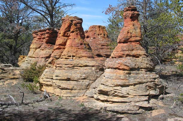
Photo courtesy of David Lopez This photo, taken by David Lopez of the Montana Bureau of Mines and Geology, was featured on the bureau’s 2004 Montana Geology Calendar. It shows unusual formations called “hoodoos” that are located several miles west of Pryor along the western edge of the Crow Indian Reservation. Hoodoos are pinnacles or pillars of rock that formed when a layer of rock more resistant to erosion overlies a layer of less durable rock. These hoodoos were formed because the tough layer of reddish sandstone cemented with iron oxide capped a layer of sandstone (tan) that was not so well-cemented. The cap of tougher sandstone caused weathering and erosion to cut downward along fractures in the formation. helping to preserve the pillars.
Which way did it flow? . . . 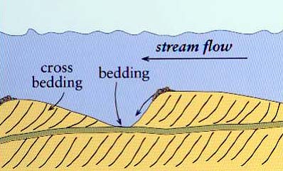 Diagram courtesy of U.S.G.S. Term: (river) channel
|
 |
*Hoodoos in southern Canada |
|
Click here to print worksheet |
|
About this site |
|
Books related to Montana Earth Science |
|
Earth Science Teacher at Helena High School |