
Below: This is a satellite view of the
same storm that spawned the tornado south
of Malta on July 21, 2001. The image, which is
provided by the G.O.E.S. East Satellite, shows
the position of the squall line (between
arrows) at 7 pm MDT. A squall line is a line of
thunderstorms formed along a cold front as
colder air pushes into warmer, especially
humid air. 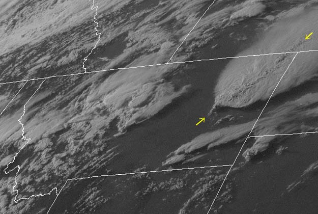 Image courtesy of NOAA |
 |
Back to the RADAR image of the tornado |
|
Earth Science Teacher at Helena High School |