|
The Big Chill
Lake Bed Sediments in the Helena Valley
Seasonal Sorting
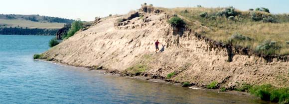
NOTE: The water shown in the photo is a part of the Missouri River known as Hauser Lake. It is about 8 miles northwest of Canyon Ferry Dam (also part of the Missouri River).
Sources: Below: Sediment from Glacial Lake Great Falls can also be seen in the cut banks along Lower Holter Lake between Helena and Great Falls (another stretch of the Missouri River). 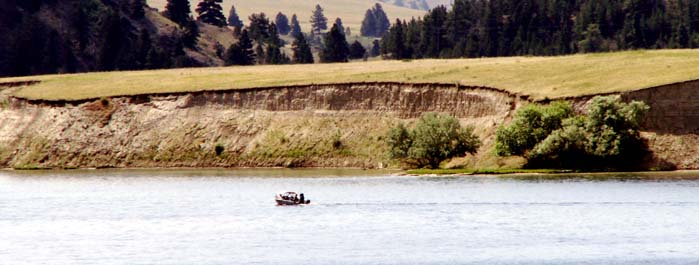 Term: varve |
 |
Shonkin Sag |
|
*Glacial Lake Missoula |
|
*Ice ages changes the path of the Missouri River |
|
Next picture |
|
RETURN TO BASE CAMP |
Below: This map shows the
approximate location of glacial lakes (blue)
during the most recent ice age. At times
Glacial Lake Great Falls extended much
farther south as evidenced by sediments
shown in the pictures above.
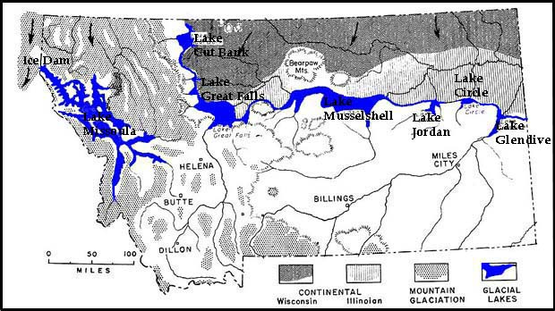 Map courtesy of Montana Bureau of Mines and Geology |