|
Glacier Park's Key Bed
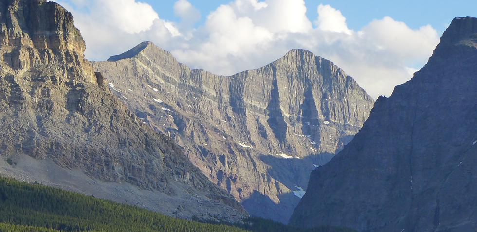
 Above: Mt. Siyeh (sunlit peak on right) looms over an exposure the "magmatic sill."
Markers in the layers . . .
Just as constellations help astronomers locate certain stars in the night sky, rock layers known as "key beds" can help geologists in the field identify the rock layers they are looking at, and compare the ages of rocks in different geographic areas where the key bed is present. In order to serve as a key bed, a layer of rock needs to be fairly widespread and easy to recognize. Quite often key beds, like the rocks above and below them, are sedimentary in origin, but they can also be layers of ash deposited over a large geographic area by ancient volcanic eruptions. One of the more famous key beds is a layer clay called the "K-T Clay" (K-T Boundary), which was deposited worldwide by the impact of asteroid roughly 65 million years ago. Geologists know that layers below the K-T Clay are older that 65 million years and those above are younger. Another that is useful in Montana is ash from the eruption of Mt. Mazama (Crater Lake, OR) 7,600 years ago.
Like a racing stripe . . . .
Although it is not nearly as widespread as the K-T Clay, the series of rock layers that make up the mountains of Glacier National Park (GNP) include what some might call a key bed. Unlike the layers above and below it, GNP's key bed is not a sedimentary rock, but rather a layer of igneous rock that used to be called the "Purcell Sill"* (now referred to as the "magmatic sill"). Sills are formed when magma forces its way in between layers of sedimentary rock and then hardens. Throughout most of the park, the sill stands out as a 130 to 300 ft. dark layer of diorite sandwiched between strips of white, low-grade marble that formed as heat from the cooling magma baked the limestone (close-up photo) . This heat also drove out organic material, bleaching the rock and causing more contrast between the darker diorite and the marble (photos). Unlike typical key beds . . .
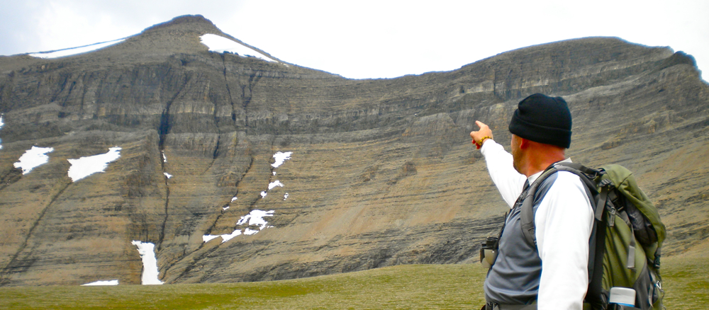
Most key beds consist of a layer of material (sediment or ash) that was deposited on a surface at some point in the past. Over time, the key bed was covered by other sediments. According to the Principle of Superposition, layers below a typical key bed are older and layers above it are younger. However, since the sill was injected between sedimentary layers that had already formed, geologists know that the layers immediately above it are not younger than than the sill. Nonetheless, the sill serves as a marker - when geologists see it they know they are looking at the Helena (Siyeh) Formation, which lies just above the older rocks of the Empire Formation, and just below the younger rocks of the Snowslip Formation. Below: This is the other side of Mt. Siyeh with the sill below it - The same mountain and sill that are shown in the photo at the top of this page. 
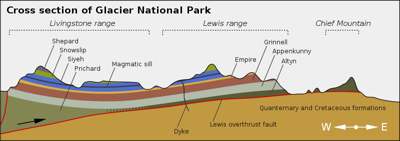
Below: The sill is labeled "magmatic sill" on the diagram below. The diagram illustrates the basic geology of the park (The Lewis Over-Thrust). The sill is not present in the Chief Mountain area because it has been eroded away from that region. 
*NOTE: Geologists no longer refer to the sill as the "Purcell Sill" (photo) because there is a "Purcell Lava" found in the park, and the two (sill and lava) are not the same age.
Terms:
key bed
| 


