|
Triple Divide
Peak in Glacier National Park 
Move your mouse over the photo to see labels.
Like the Matterhorn . . .
The peaks shown in the photo are "glacial
horns" located in Glacier National Park.
These pyramid-shaped features are formed
as three or more glaciers erode the sides of a
single mountain. The larger peak in the
background is Mt. Stimson and the smaller
horn in the center is called Triple Divide
Peak. Triple Divide Peak was so-named
because runoff from each of its three sides
drains to a different watershed. (Runoff is melted
snow or other forms of precipitation that drain
off the land.) Melted snow from the west
slope (left side) flows toward the Gulf of Mexico, runoff from the
northeast slope (right) flows toward the Hudson Bay, and
the southwest slope (not shown) drains to the Pacific.
Dividing lines . . .
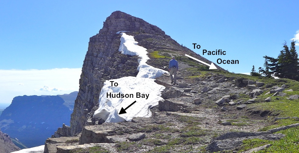
The photo was taken near a ridge separates
the Gulf of Mexico and the Hudson Bay watersheds (drainage basins). Such areas are known as "divides". Divides are
higher areas (not always distinct ridges) that separate drainage basins.
The most famous divide, "The
Continental Divide" (a.k.a. the Great Divide), is
also shown in the photo. More about Triple Divide Peak . . .
Click on the
"Hot Link" below for a better look at Triple
Divide Peak. Also, here is a more complete account of two hikes to the summit of Triple Divide Peak (including a linn to a photo tour).
Below: This is the divide between the Gulf of Mexico and Hudson Bay watersheds. Click here to see a photo taken along the Gulf of Mexico-Hudson Bay divide, or here to see one taken along the Gulf of Mexico-Pacific divide (a.k.a. The Continental Divide). 
Terms: erode, drainage basin
| 


