
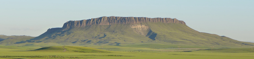
 The East Side of Crown Butte Crown Butte is one of several laccoliths scattered throughout central Montana. Here are some others:
What is the purpose of the diagrams shown on this page? To answer this question, watch the short PowerPoint presentation, look at the diagrams, read the captions and think!. The diagram below shows the laccolith 75 million years ago (dike is not shown). Magma squeezed between rock layers, causing the layers above to dome upward slightly. The magma hardened beneath the surface. Move your cursor over the image below to see the laccolith today. The rock of the laccolith is more resistant to erosion than the sedimentary layers above and below, so it can be seen today as the cliffs of Crown Butte.
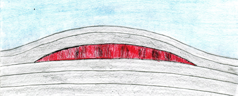
Below: These two diagrams show how the Square Butte (laccolith), 50 miles east of Great Falls, formed. the diagram on the left (or top) show the laccolith, as well as the dike that supplied the magma. In the diagram on the right (or bottom), erosion has stripped off the overlying sedimentary rocks, leaving the remains of the laccolith and dike exposed at the surface 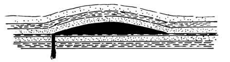  The diagrams above are from a special publication of the Montana Bureau of Mines and Geology called Profiles of Montana Geology (publication #89). Although it depicts a butte located 50 miles east of Great Falls, the formation of Crown Butte was very similar. Laccoliths are a type of intrusive igneous formation . . . . also called "plutonic formations" or "igneous intrusions". This means that they were formed as magma cooled beneath the surface. With laccoliths the magma moves into an area beneath the ground, causing the overlying rock layers to dome upward. After the magma becomes rock, it is exposed as the less durable rock above erodes away as shown in the diagrams. The Little Rockies, located on the southern part of the Ft. Belknap Reservation are considered by many geologists to be a laccolith. However, the laccolith that caused the Little Rockies has a greater diameter and is deeper, and the exposed igneous rock resulted in a small mountain range, rather than a flat-topped butte.
Below: This photo, taken by Bob Rumney, shows Crown Butte as viewed from the southwest. Even though they are shaped much differently, Birdtail Butte (left) and Haystack Butte (right) are also laccoliths. 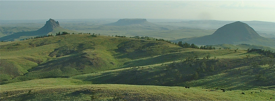 Photo Courtesy of Bob Rumney, Cascade Area Rancher |
 |
3. The Crown Butte story |