|
Montana's "Rock of Ages" 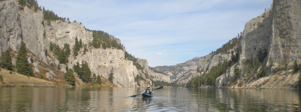
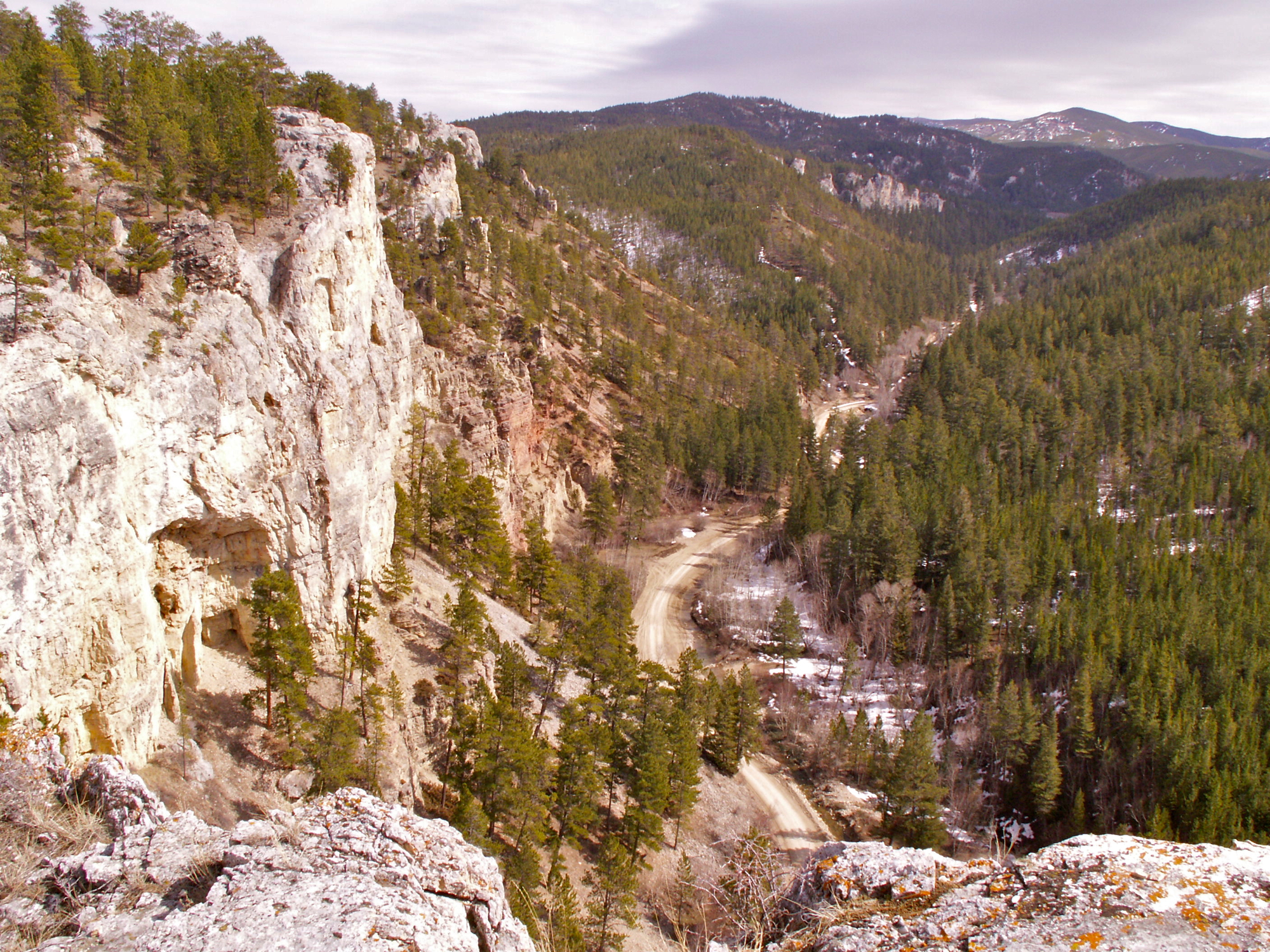
Gates of Mountains Recreation Area 20 Miles North of Helena
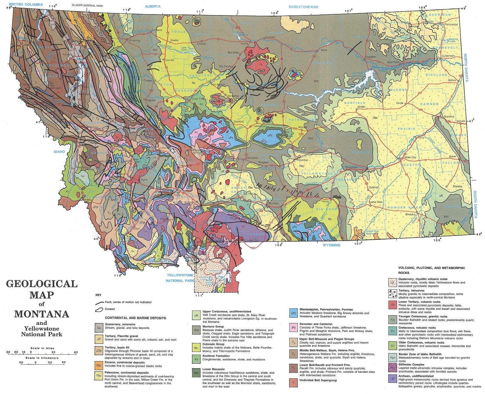
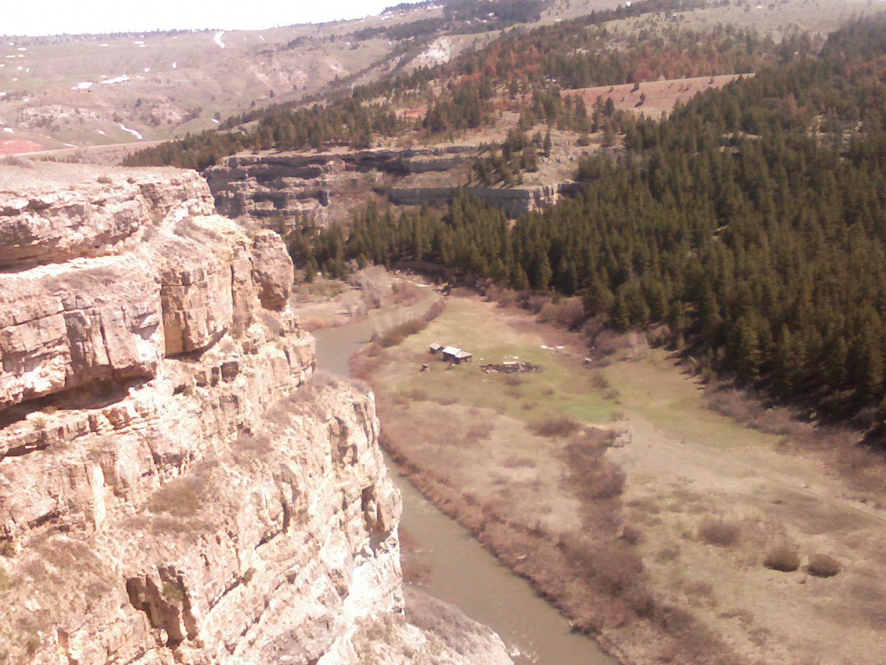
If Montanans ever decided to select a state rock formation, a pretty good argument could be made for the Madison limestone. This "Madison Formation" (aka Madison Group) can be seen in many of our state's more recognizable landscapes (listed below). The photo above shows cliffs of Madison limestone near the southern end of the Gates of the Mountains Recreation Area. Below is a list of some other places where you can see outcroppings of Madison Limestone. It can be found near the surface in the sky-blue areas (labelled "uPZ" in some places) on this Geologic Map of Montana (click on the map to enlarge it when the page opens up).
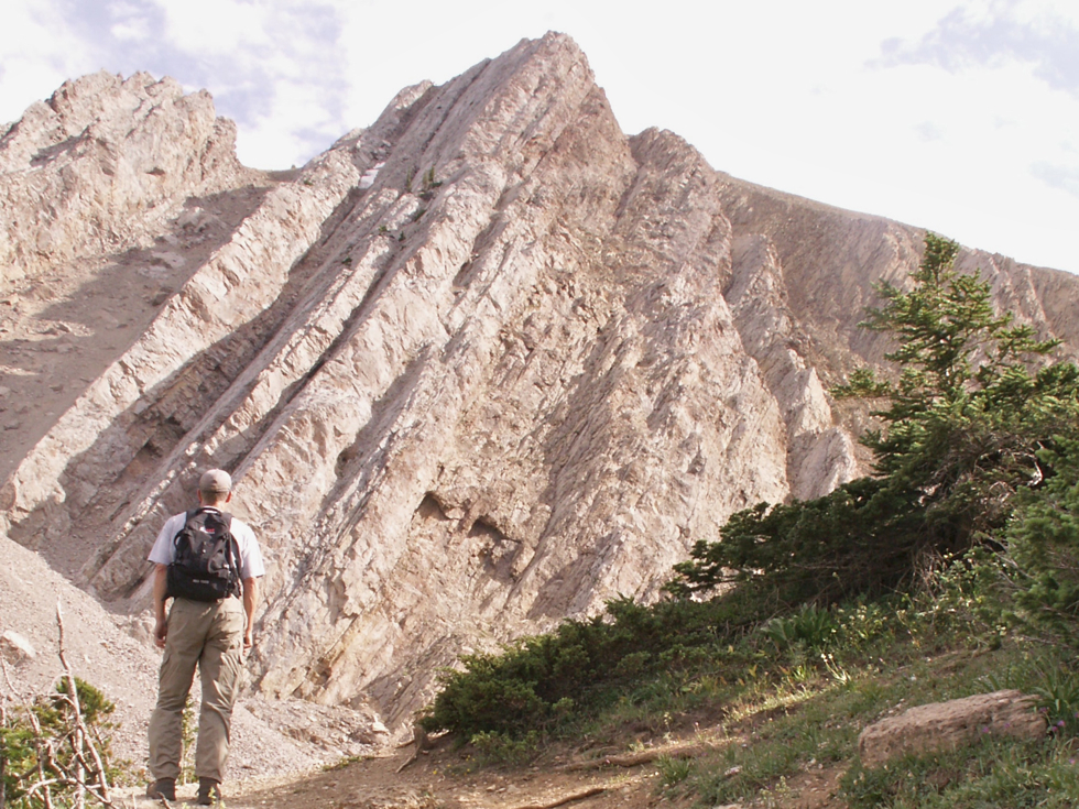
1. The Bridger Mountains (photo near Sacajawea Peak) and the Horse Shoe Hills (Bozeman area)
2. The Little Rockies in north-central Montana, including Mission Canyon
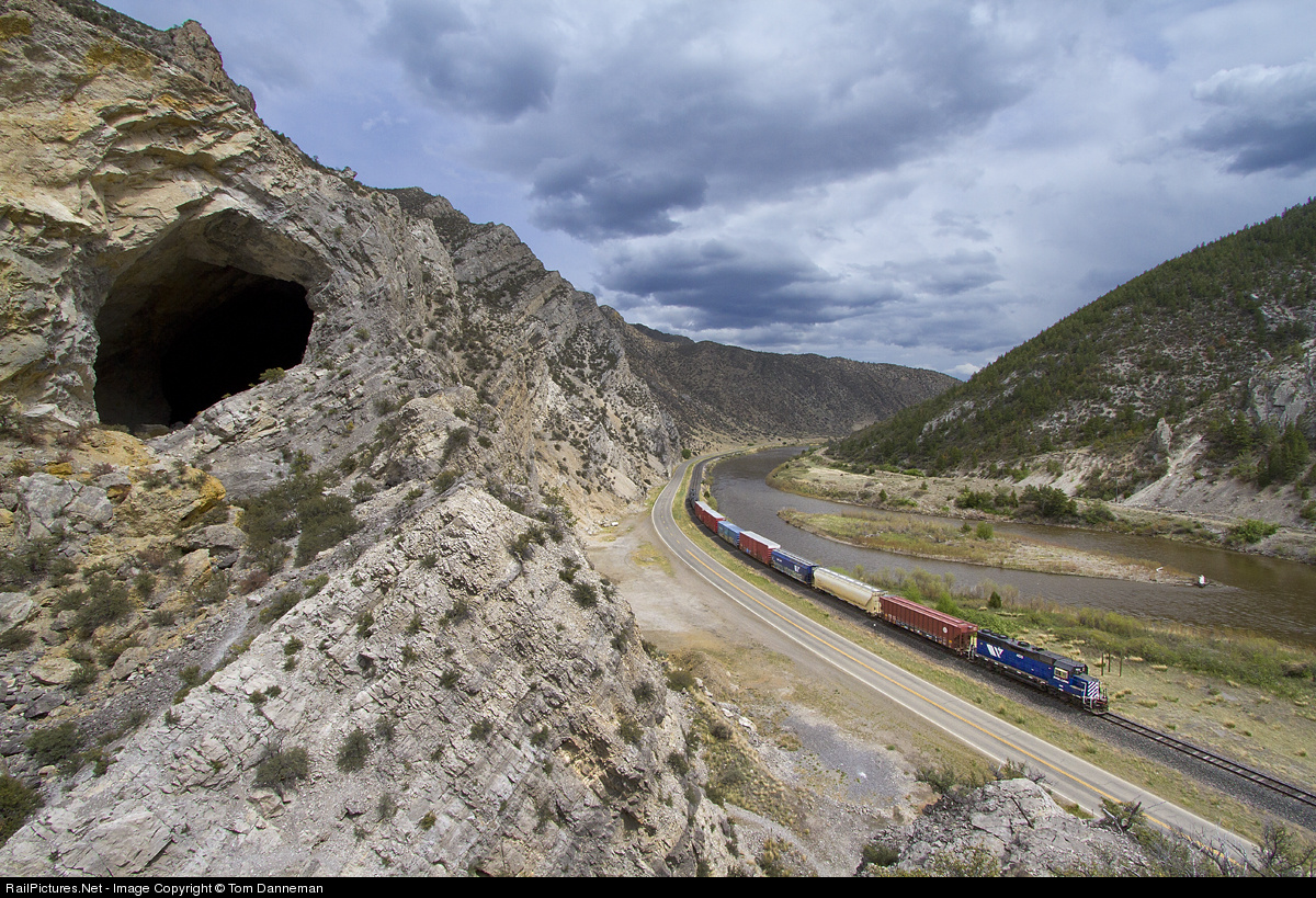
3. Lewis and Clark Caverns and Jefferson Canyon near Three Forks
4. The Sawtooth Range and Sun River Canyon between Helena and Glacier Park
5. The Little Belt Mountains, including Sluice Boxes State Park southeast of Great Falls and along the Smith River
6. Bighorn Canyon and the Pryor Mountains south of Billings
7. The mountains north and south of Lewistown (Judith and Snowy Mtns.)
8. The Jefferson Canyon south of Whitehall and the Headwaters State Park near Three Forks
9. The Castle Mountains southeast of White Sulphur Springs
10. Beaverhead Rock near Dillon
What is a "formation"? . . .
To a geologist a "formation" (or "group") is a thick layer (or series of layers) of a particular type of sedimentary rock covering a large geographic area. Some of Montana's more famous formations include the Hell Creek Formation, the Judith River Formation, and the Two Medicine Formation, which have all yielded significant dinosaur fossils. The familiar"Rimrocks" of Billings and the White Cliffs east of Ft. Benton are both exposures of the Eagle Formation. The Madison Formation consists of sediment laid down during the Mississippian Period of the Paleozoic Era (roughly 350 million years ago). It was laid down over most of Montana, eastern Idaho, northern Wyoming, and the Dakotas. The Madison is between 1,000 and 2,000 feet thick throughout most of the Montana.
GEOLOGIC TIME SCALE
Reading the rocks . . .
One reason geologist get so excited about rock formations is that they provide clues about what the environment was like in that location when the sediments were being deposited. For example the Eagle Formation consists of sand deposited near the shore of a shallow inland sea, whereas parts of the Judith River Formation indicate the presence of deltas much like the one at the mouth of the Mississippi River. Based on the types of fossils contained in the Madison Formation, geologists think its sediments accumulated on the floor of a tropical shallow sea. The map below shows where geologists believe Montana was located during this time (the Mississippian Period - CLICK HERE to see a colorful map).
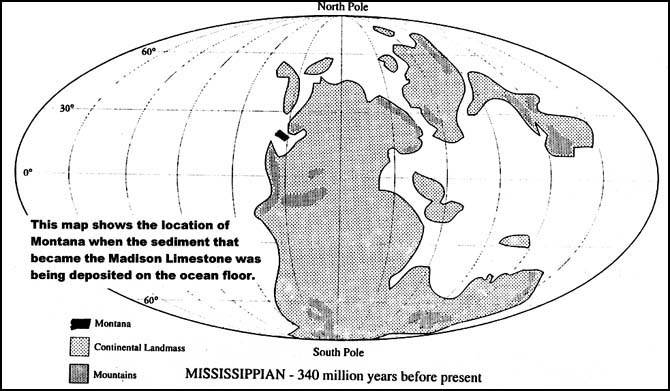 Map courtesy of Jim Schulz, Helena High Science Dept.
A deposit of calcite sediment . . .
Although it comes in many forms, all limestone is primarily made up of the mineral called calcite (calcium carbonate; CaCO3). This mineral is produced as marine organisms draw calcium carbonate out of the water in order to build shells or other hard parts. As these organisms die their soft tissues decay, but the shells, etc. made of calcite build up as sediment on the sea floor. Tropical waters also support abundant seaweeds that excrete calcite, which precipitates onto the seafloor as a light-colored lime mud, especially during periods of evaporation. Judging by the thickness of the Madison Limestone, this tropical marine environment persisted for many millions of years.
Terms: excrete, precipitate
| 
