
|
What's so special about this area?. . .
How did it get there?. . . Below: Move your cursor over this Google Earth image of the Cedar Creek alluvial fan shows what the area would look like if your were approaching (flying) from the west. You can see Ennis Lake, the town of Ennis, and Cedar Creek cutting through the alluvial fan. Cedar Creek is a tributary of the Madison River which flows northward (right to left across the center of the image) into Ennis Lake. Soils have developed on top of the gravels, and grasses have taken root. Cedar Creek continues to wind its way over the fan. 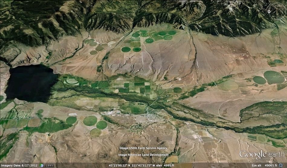
Term: alluvium |
|
Earth Science Teacher at Helena High School |
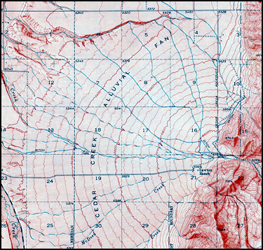 The area shown on the map is located a 5
miles southeast of Ennis (30 miles northwest
of
Yellowstone Park). A photo of the area is
shown to the right. The map, which represents an
area about 5 miles x 5 miles, was copied from
an older USGS contour map. Such maps,
often called topographic, or "topo" maps, use
contour lines to show the shape of the land.
Older ones also used shading to help the
map-reader visualize the topography.
The area shown on the map is located a 5
miles southeast of Ennis (30 miles northwest
of
Yellowstone Park). A photo of the area is
shown to the right. The map, which represents an
area about 5 miles x 5 miles, was copied from
an older USGS contour map. Such maps,
often called topographic, or "topo" maps, use
contour lines to show the shape of the land.
Older ones also used shading to help the
map-reader visualize the topography. 