|
This decision
looks like a "no-brainer." 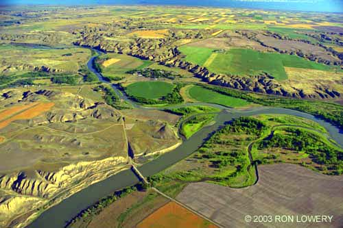
Photo courtesy of
Ron Lowery
Chasing Lewis and
Clark
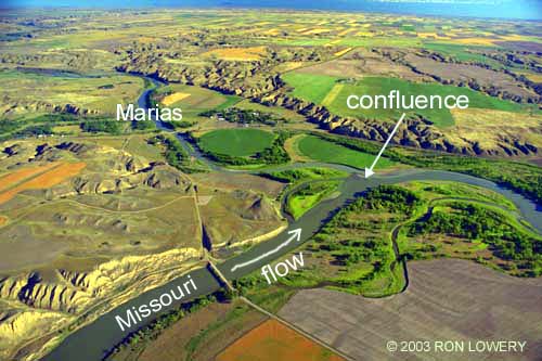
A fork in the river . . .
This aerial photo, shows the confluence of the
Marias and Missouri Rivers 10 miles
northeast of Ft. Benton. Scroll to the bottom of
this page to see a labeled photo. When the
Lewis and Clark expedition reached this
confluence on June 2, 1805 they faced a tough
decision. The Mandan tribe, which they had
spent the winter with in North Dakota, made
no mention of this "fork" in the river, so the
expedition was not sure which way to go. As
one historian put it, they had reached the
"where the hell are we" phase of their
expedition. In the photo it seems obvious
which branch is the main channel (the
Missouri River). Perhaps in the spring of 1805
an usually high amount of runoff in the to the
northeast of here (Marias Basin) made it
difficult to distinguish the main channel from
its tributary. Although they found the south fork
to be wider (372 yards) compared to the north
fork (200 yards), the muddy water in the north
fork more closely resembled the river that they
had been traveling on since leaving the
Mandan village earlier that spring. On the
basis of its muddy appearance, the men
strongly believed the north fork to be the route
that they should take.
Decision Point . . .
Lewis and Clark didn’t agree their men, but
they realized the importance of choosing the
right course. So, the expedition camped for
nine days while they investigated the two
rivers. The captains began the investigation by
dispatching three men in canoes up each of
the forks. While they were gone, Lewis
climbed to what is now called Decision Point
Overlook for a better view of the surrounding
land. He believed that one channel traveled
too much from the north to be the Missouri,
and that its waters were not clear enough to
be from the
snow-capped peaks of the Rockies that he
could see in the distance. When the canoes
returned their findings proved inconclusive, so
the captains set out to see for themselves.
Clark went forty-five miles up the south fork,
finding that it ran swift and true to the west of
south. He returned, convinced that it was the
Missouri. Lewis went nearly eighty miles up
the north fork, confirming that it headed from
too much to the north for their route to the
Pacific. Their decision to follow the south fork
was confirmed when they reached great
waterfalls that the Mandans had told them
about (near present-day Great Falls).
Tribute to a cousin . . .
Once Lewis determined that the north fork
was not the Missouri he decided to name it
Maria’s River in honor of his cousin, Miss
Maria Wood. Over the years the apostrophe
was dropped and the pronunciation changed
to “ma-RI-us”.
|