
|
Visitors are amazed by the tremendous slope, and ruggedness of the terrain. Photographs tend to soften both of these. This photo was taken from near the top of the ridge . . . above the crevice identified by Sallee on two different trips to the ridge (one with Norman Maclean in 1978 and the other with his son, John Maclean in 2003). Norman Maclean argues the crevice had to be beyond the "?" because you can't see the place where Dodge set his escape fire from this vantage point. One interesting (and confusing) aspect of the rimrocks (sometimes called "reefs" by Maclean) is that along much of the ridge there are actually two distinct levels of rimrocks (the one marked with a "?" and the one several feet above). It seems important, but Maclean doesn't mention the two levels. He does write that, "They (Rumsey and Sallee) ran upgulch on top of the ridge for a hundred yards or so and staggered down the slope on the other side of the ridge." If you were to visit the gulch, you would see that it is impossible to run "on top of the ridge". Maybe they were running between the two levels of rimrocks shown in the photo (where the trees are; above and to the right of the question mark). 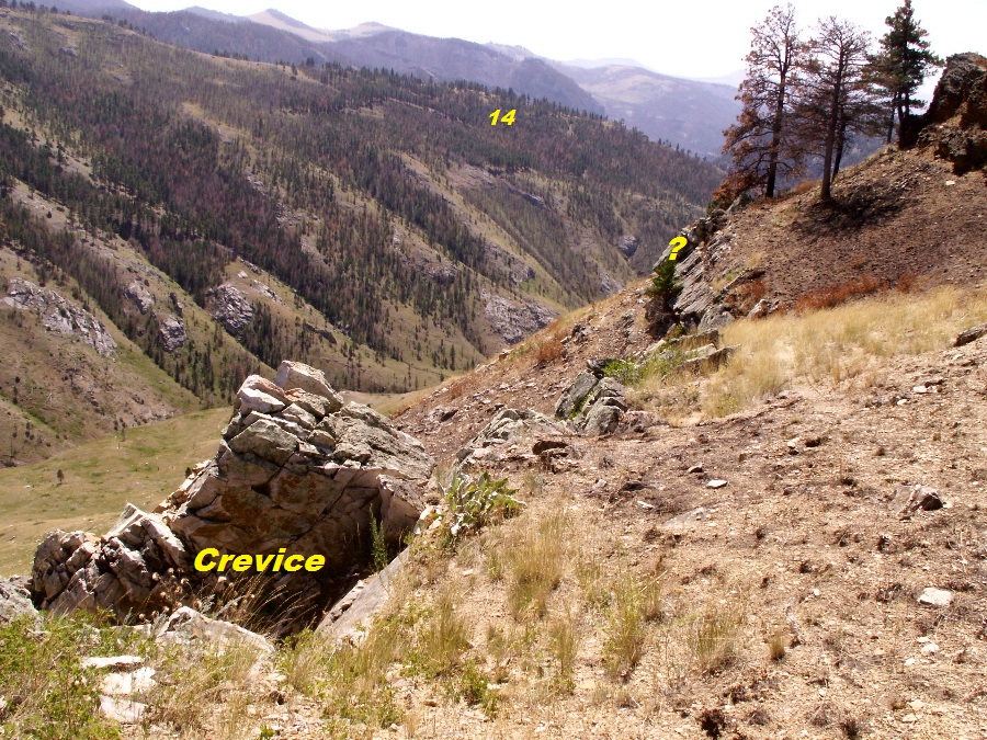 Below: This view is in the opposite direction. The helicopter landing spot is behind me and the area where the men landed with their parachutes is to my left. Rescue Gulch is to my right. (Photo by Bill Pifer) 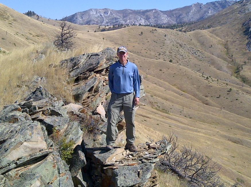 |
